Data Visualisation: Primary Schools in Ireland
I’ve put an early version of some data visualisation work I’ve been playing with up at schools.davidkelly.ie.
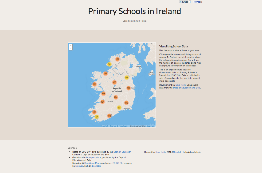
I’ve been interested in the types of open data that are available in Ireland, and because primary schools are something we’ve been looking at anyway, it seemed like a good place to start experimenting. I found data published by the Dept. of Education & Skills that lists the mainstream primary schools for 2012/2013 2013/2014 (data updated 1st July, 2014), along a separate dataset that lists class-sizes in those schools, and another (published on data.opendata.ie) that had already geo-coded all the schools.
Version 1 details
In the first version published, over 3,100 primary schools are mapped in clusters. Zooming in on the map will display schools as individual pins. Clicking on a pin will show the school name, which can be used to display more detailed background information on the school, and its associated class-size data.
Future Updates
The next step is to use some charts to explore the data a little more.
Current Problems
It wouldn’t be a first version if there weren’t some problems.
- There’s a bug with the first version that is crashing both Chrome & Safari browsers on iOS7.0 devices (iPad / iPhone) – it’s to do memory management on the device and the map clustering; it has being fixed by Apple in the beta version of 7.1. I’m not sure if it’s fixable before then without removing clustering.
- There’s no Internet Explorer support below IE9; that probably won’t change.
Thoughts, suggestions, and any problems found are welcome…